The Geographical Conundrum of Isle Royale
By Tim Cochrane

As the Canada–United States relationship is topical today, it is instructive to look at a recurring theme of Canada supposedly claiming Isle Royale. Certainly, the geography of the Island and its proximity to Canada seem to play on Americans' minds. Isle Royale or Minong’s isolated location in Lake Superior has spawned numerous theories, distortions, national paranoia, state pride, and even epic fantasies. For state-minded folks, the question has been (stated from a Minnesota resident’s perspective): why is it part of Michigan rather than Minnesota, but considerably closer to Minnesota? [This question deserves a fuller answer at another time.]
But an even larger question is why it’s part of the United States rather than Canada. This question apparently leads to periodic angst which surfaces in marvelously indirect and sometimes humorous ways. After all, the bulk of Isle Royale is closer to Ontario than even Minnesota and the official international border is a mythic line in the lake and only agreed upon in 1842.

When discussing this, the Grand Portage tribal chairman pointed out to me that Pigeon Point, the easternmost point of the reservation, is closer to Minong than even the Ontario islands surrounding Thunder Bay. Perhaps more important to note here, is today, the closest two neighbors to Minong are the Grand Portage and Fort William First Nation Anishinaabe. With the recent land settlement between the Province of Ontario and the Fort William First Nation, the bulk of Pie Island is now part of their reserve.
The confusion and bit of paranoia about who could claim Isle Royale began quite early. And it roughly coincided with the published accounts of Charlie and Angelique Mott’s legendary tragedy. Through a betrayal, the Motts are marooned on Isle Royale, starve, and eventually Charlie died. While the legend’s popularity grew with time, there was a competing and perhaps even more popular published story of the Hudson Bay Company claiming Isle Royale. Here is an example from a Louisville, Kentucky newspaper:
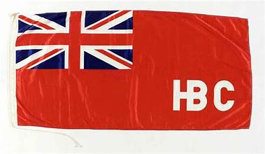
This story ran in newspapers in more than 11 states, though tellingly, not in Michigan or Minnesota.
In 1845, the year of this supposed invasion, the Fort William Hudson Bay Company post was in a period of transition. Fur returns (financial return on furs) were a shadow of the past, so the company had turned to commercial fishing and outfitting mineral prospectors. Like the American Fur Company, the Hudson Bay Company invested in commercial fishing in Lake Superior to bolster profits. At its height, the Hudson Bay Company had 17 fishing stations on Lake Superior, including some outside of Thunder Bay. Overall, however, the Fort William post was not expanding, it was maintained, ironically, in great part as HBC protection from expansion of American (fur companies) into Canada.
Unbeknownst to the Americans, but of interest to us today, the HBC clerk at Fort William did something new, for one year. Company superiors required him to keep a phenological journal of a year leaving us of the North Country with a rare record of seasonal changes that apply to nearby Isle Royale and Grand Portage. Here is a sampling from the “Thermometrical Journal:” “September 2, low 53 F, high 60 F, SE winds, fresh, clear, The Rein deer [caribou] rutting season terminates about this time according to Indian accounts.” Or, December 19th, low 3 F, high 14 F, wind WNW, light clear, Mild – the Thunder Bay [ice] is taken as far as the Thunder Point across to Pattie [Pie] Islands.” And finally, January 17th, low -21.5 F, high -4.5, winds north, light, clear, Cold, suckers are somewhat abundant at this period amongst the Welcome Islands.”

A later, second instance of a Canadian “threat” to acquire Isle Royale – really more a farce—came in August 1907. The Tacoma (Washington) Daily Ledger had a great headline: “Isle Royale Seized by Canuck.” A Captain Samuel Crawford Young of Fort William and some members of the 96th Lake Superior Regiment made headlines when they claimed Isle Royale would become British when they planted a British flag on it. Perhaps to create some dramatic tension, several newspapers then ran a headline “British Flag not flying over Isle Royale Yet.” For a couple days, follow up articles in U.S. newspapers debated if they ever made it to the Island. A Rochester, New York newspaper’s headline captured the conclusion to all of this, “Young Antics Create a Laugh.” Throughout the newspaper coverage in more than a dozen states, no government officials (in Ottawa, London, or Washington) rose to respond to this rumor. And the U.S. Custom Official on the Island never saw Captain Young and his usurpers.
During my time at Isle Royale, two isolated incidents remind us that the island’s proximity to Canada can still make for peculiar cross-border events. One winter, with solid ice, a Canadian snowmobile party (3 or 4 machines) made it close to Huginnin Cove (due north of Windigo or Ozaagaateng). However, one snowmobiler must have had a scare as one sled developed engine trouble and was abandoned on the shoreline. National Park Service rangers found it on spring opening patrol. And in another instance, during a cold, dark evening of winter study on the island, we learned that a mysterious airplane had made a forced landing somewhere on Isle Royale. Uncertainty ruled. Hours later we learned it had landed on the frozen Siskiwit Lake. While confusion reigned, a few jumped to nefarious conclusions such as it must have been drug runners. At least one of us went to bed that night expecting the worst (has a winter study door ever been locked at night?). The reality was much more mundane, a student pilot on a whim flew from Thunder Bay over the Island and the plane’s fuel line started to freeze up forcing him to land. He was “rescued” the next morning by the U.S. Coast Guard helicopter before most of us got a good look at the plane or pilot or arrest anyone.
As these stories illustrate, we seem prone to periodic wild notions that Canada might invade or surreptitiously visit Isle Royale. Worse, something shady might be going on. None of the threats have been real, but the stories live on. The geographic reality of Isle Royale’s proximity to Canada seems like catnip to our imagination. It’s as if we have an unfulfilled niche for stories of Canadians behaving badly at Isle Royale.
About Tim Cochrane

Historian, author, and NPLSF board member Tim Cochrane served as superintendent of the Grand Portage National Monument for twenty years, co-managing the site with the Grand Portage Anishinaabeg through a Tribal Self-Governance Act agreement. A reluctant bureaucrat, he wrote as an aside and as a creative outlet to his park service duties. His books include Minong–The Good Place: Ojibwe and Isle Royale and A Good Boat Speaks for Itself: Isle Royale Fishermen and Their Boats; and Making the Carry: The Lives of John and Tchi-Ki-Wis Linklater. Explore Tim's Books on Goodreads. He is currently working on a new book, Storied Minong: Isle Royale Spirit of Place.
Over the coming months, Tim will be sharing more stories about Isle Royale’s history, so stay tuned!
Continue exploring Tim’s stories of Isle Royale history:
[1] For conspiracy minded folks, this information has all the hallmarks of being authored by Cyrus Mendenhall, the copper seeker, who was responsible for the Motts’ abandonment. A similar article written by Mendenhall about the Motts appeared in the Cincinnati Inquirer. If this was authored by Mendenhall, the question becomes why so? Was this rumor of an HBC invasion part of diverting attention from his role in Charlie’s starvation death and Angelique’s trauma? It’s likely we’ll never know. But I relook at the Mott legend in my forthcoming book: Storied Minong.
About NPLSF

The National Parks of Lake Superior Foundation (NPLSF) exists to provide financial support for projects and programs that preserve the natural resources and cultural heritage of the five Lake Superior national parks: Apostle Islands National Lakeshore, Grand Portage National Monument, Isle Royale National Park, Keweenaw National Historical Park, and Pictured Rocks National Lakeshore.
Funded through grants and private donations, NPLSF projects and programs ensure that these great parks and historic sites are maintained for the enjoyment of all current and future visitors.
To learn how you can support our work, visit nplsf.org/donate.